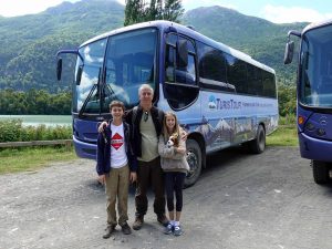
by Maile Bowles | Feb 5, 2018 | Maile, South America
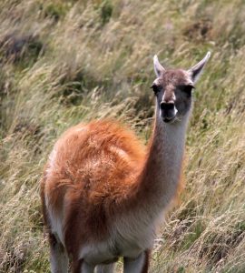
Patagonia is a beautiful and exciting place to be. Patagonia is a huge area in the southern parts of Argentina and Chile. It has many gorgeous hikes with beautiful glaciers. One of the most famous parks in Patagonia is Torres Del Paine in southern Chile. One of the most famous hikes in the park is known as the “W”. It’s known as the “W” because if you look at a map it looks like a W because you are going up three different valleys. Our goal was to do this hike. From the moment we entered the park, we started to see new and strange animals. One of my new favorite animals is a creature called a guanaco. Guanacos are basically wild llamas. Also, there are wild horses, however, we never saw any. Pumas are another common animal in the park. The pumas hunt guanacos and rabbits.

Guanaco
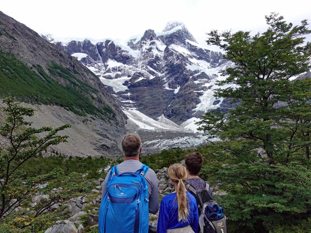
Unfortunately, we didn’t see them. On our first hike in Torres Del Paine, The French Valley, we saw a gorgeous glacier with waterfalls running off it. There are many lakes up in the mountains because of the glaciers melting. On our way back, our guide, Mariana, told us that the reasons all the trees were dead was because of a fire a tourist made because he was camping in an area he wasn’t supposed to, then he tried to burn some toilet paper but the wind was so strong it caught lots of trees on fire. In the end, he was fined only $600 even though he burned 50,000 acres. Also, once we went around one hill, the wind kicked in. It was blowing me away so much, that Mariana had to grab me to keep me from going off the trail. The wind was going 30 miles per hour and the strong gusts of wind were 60 miles per hour.
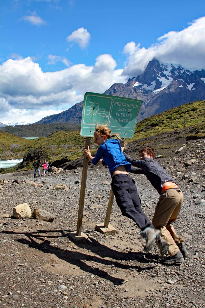
Very windy on the trail.
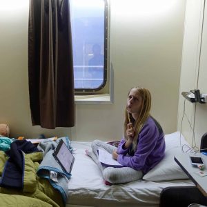
After a long day of hiking we went and ate dinner at the Refugio, then had a nice scalding hot shower. My Mom said that it was the hottest shower she had ever had in her life. The rooms had three bunk beds that you would share with other people, but our room was just us and Mariana. I skipped the second hike because the wind was constantly going 60 miles per hour and I knew I would slow everyone else down, so I stayed inside with my Mom, who had injured her knee. The third hike was very fun. We hiked up to see the towers that gave the park its name.
Gazing at the towers.
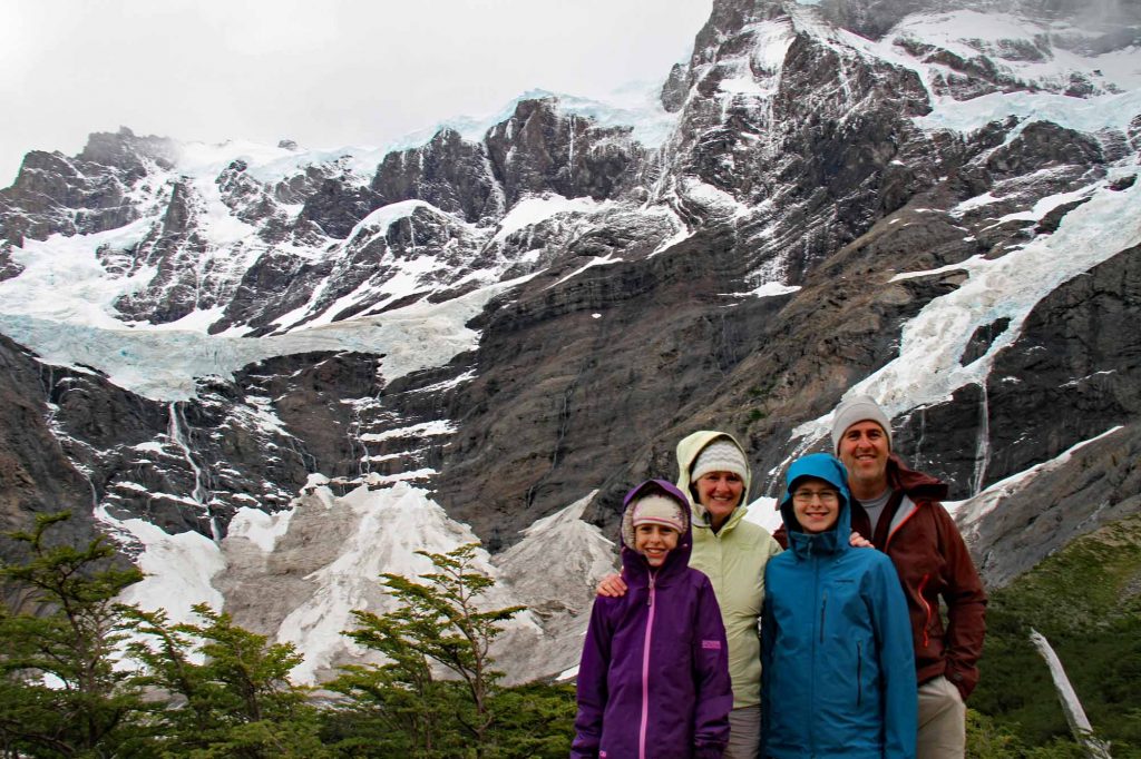
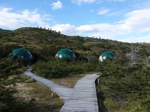
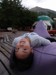
We saw a huge glacier. We also saw many avalanches on the glaciers. It’s a normal thing for avalanches, though. The waterfalls from the glaciers formed a lake at the base of the towers. We saw two men get in the ice-cold water for a picture. We stayed at a hotel called Eco Camp. It was a collection of green domes that are used as hotel rooms. In our dome, the loft which was where Alex and I slept was burning hot. We would open the windows, but we could not open them that wide because of the wind. We had a very spiffy dome. It’s called Eco Camp because they try to be ecologically friendly. We did a lot of hiking and now I think my legs are broken.
The French Valley.
by Alex Bowles | Feb 4, 2018 | Alex, South America
Today we went to Torres Del Paine, located in Southern Chile or otherwise known as Patagonia. Torres Del Paine is in a local language and translates to Towers of Blue. On the way to the Parque national we saw many guanacos, they are related to llamas, but the difference is all llamas are domesticated and guanacos are wild. Many of the guanacos would stop eating, raise their long necks and look at us which made me feel a bit sad and hungry. They are interesting animals with their long necks, soft fur and the ability to use spit as a defense, but they are so delicious. We were told inside the Parque National the population of pumas, called mountain lions and cougars in the United States, has boomed and that we had a good chance of seeing them and a couple weeks before we arrived, one was seen around our hotel.
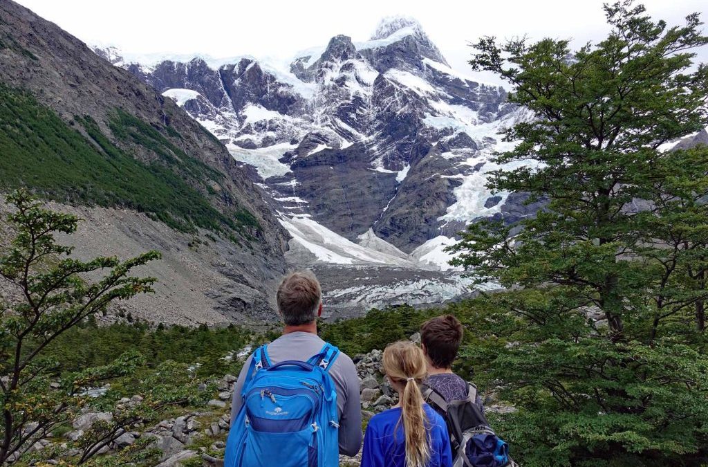
When we arrived at our hotel, Ecocamp, we were led to our dome. It had a loft with two beds and two beds pushed together on the lower floor. We were told not to open all our stuff because we would leave tomorrow morning to go to the Refugio Paine Grande. To get to the Refugio we had to take a van to the dock, ride a short boat ride, pequino when compared to the Navimag ferry. When we arrived at the Refugio we dropped our bags and headed off to hike the French valley. Before we could reach the French valley, we had to hike 10 kilometers to get to the Italian camp then start the trek up the French Valley. On the way to the Italian camp, we passed through a forest, of burnt trees. Our guide, Mariana, told us the fire was started in December of 2011 when a guy, camping in an area he wasn’t supposed to camp in, decided to burn toilet paper. The small fire he made was blow out of control when the 90 kilometers per hour gust spread the fire to the Lenge trees and burned 18,000 hectares. When we made it to the Italian camp, we started the medium difficulty hike up to the French glacier. To get to the lookout we had to hike up the moraine of the glacier, the area where rocks were discarded as the glacier retreated. It was a little difficult to climb but the view was worth it. From the lookout, we could look down the valley and see the greyish blue lakes, gray from the sediments as the glaciers melted. Then, when we were standing and admiring the hanging glacier we hear a crack and watched as a chunk of ice fell off the numerous cliffs. As it rumbled down the cliffs it gathered snow and speed. When it reached the final cliff, it fell about 70 meters and lasted a few minutes. On the way back to the Refugio, we had a constant wind of 50 kilometers per hour and gusts of 90 kilometers per hour which scarred Maile enough to not go outside at the Refugio except when needed. At dinner, Maile begged my Dad not to do the next day’s hike because she was afraid she would blow away.
View of the French Valley Glacier
The next day my Dad and I hiked the trail to Glacier Grey. Maile, because she was terrified by the concept of wind as strong as yesterday, wimped out of the hike. The hike to the lookout was uneventful. There were gray clouds that followed us all day. When we made it to the lookout we saw Glacier Grey and some icebergs in Lago Grey. At the lookout we were given a choice, hike eight more kilometers to the shore and hope that the boat is not canceled; if the ferry was canceled we would have to run 16 kilometers to get the 6:30 ferry at the Refugio or turn back now and get the 1:30 ferry. We decided to catch the 1:30 ferry and not test our luck because yesterdays ferry was canceled due to wind and today was supposed to have the same weather. We got to the Refugio an hour earlier than the boat left and relaxed. We boarded the ferry, rode to the other side, saw some waterfalls and learned that the boat did run on time.
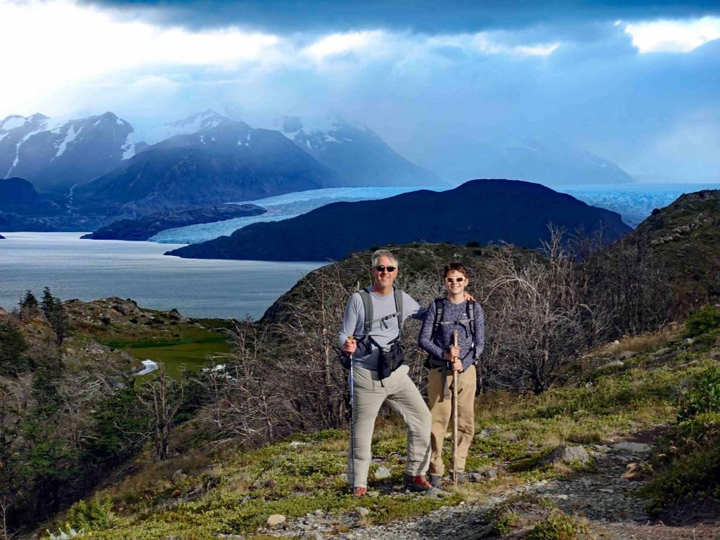
Grey Glacier
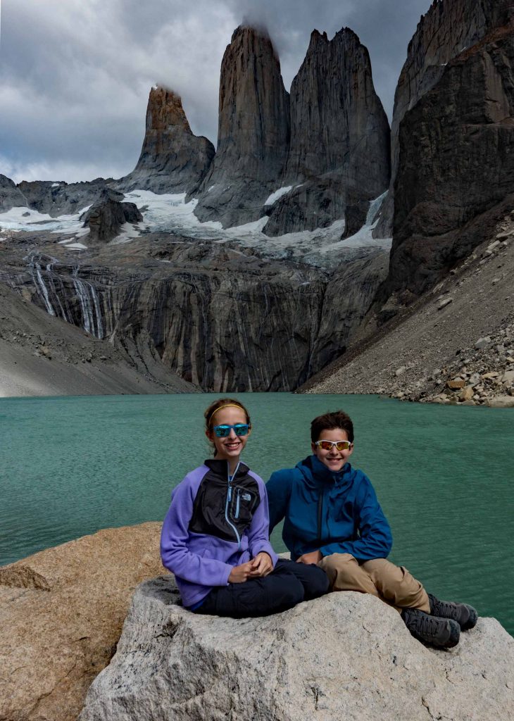
The final day we were going to do the base of the towers hike. We started early, just like every other morning, and started the trail. Before we could get to the actual trail we had to walk two kilometers on the dirt road then cross a bridge to the other side. We waited in line and watched ten people cross at a time, and as we got closer to the bridge we noticed a sign. The sign read, “Two people at a time please.” After that, we started the ascent of the trail. When we made it to a big tree growing in the middle of the path my Mom decided to turn around. She hurt her leg going down the French valley and didn’t want to hurt herself again. Maile didn’t want Mom to leave, and so she had a meltdown. It took about thirty minutes for her to calm down; the only thing that motivated her to continue was the prospect of getting a life-sized emperor penguin plush. The trail only got steeper and more hazardous from there. We decided to take the horse trail because it was cleared of debris and the dirt was packed down. After we rounded the windy pass we descended into the valley and into the Chileno camp. From there we continued to hike up the valley and across bridges until we reached the moraine of the glacier. This moraine was the hardest thing I have climbed in my life! There were huge rocks in the trail you had to go over. On the way up, we saw a team of people pulling and pushing this form of a wheelchair so that a disabled woman could see the towers. When we finally made it to the top the first thing that caught my eye was not the towers, but the numerous waterfalls that fell hundreds of meters from the hanging glaciers to a lake below. Our feet hurt so much when we reached the lookout we called the hike “Towers of Pain”. We ate lunch at the base of the Towers and took some pictures of the glacier-fed waterfalls with the towers in the background. Then we saw a crazy person take off his shirt, grab a bottle of wine, walk into the water and swim in the freezing cold water. Just for a picture. Then we saw another person do the same thing. After that, we walked down and made it back to the domes at Ecocamp to relax.
by Jason Bowles | Feb 3, 2018 | Jason, South America
A few photos for now, more to follow from Torres Del Paine.

Ecocamp, Torres Del Paine.
Francis, our new friend from Tuscon.
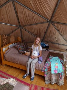
The loft in our dome.
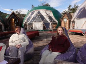
Relaxing by the community domes with a great view of the towers.
by Alex Bowles | Jan 29, 2018 | Alex, South America
Day 1
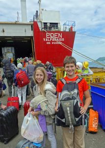
 Boarding the ferry.
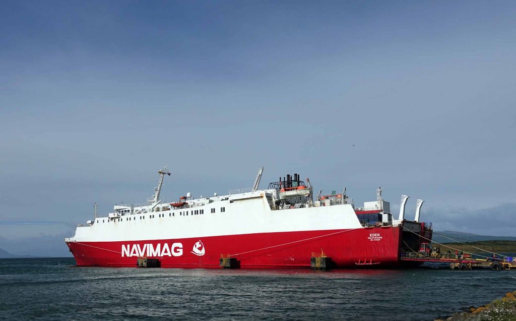
We just boarded the cargo ferry, Eden, in Puerto Montt, Chile; the boat is bigger than I imagined. Maile has been extremely excited for the ferry ride, saying it is the part she is most looking forward to. She is even more excited about the ferry journey than seeing penguins in Antarctica! Maile and I are a little bummed because we were just informed we would not have bunk-beds but instead, two rooms. Before we could explore the ship, we had to climb four flights of ladder-like stairs, each of us carrying 30 pounds of luggage. After dinner, the realization of what this journey will be like has finally sunk in–no Wi-Fi!
Day 2
We woke up to cloudy skies and had breakfast. The sky outside was cloudy and rained for most of the day. The breakfast was small and not like any other meal on the boat. Maybe they were giving us less food, so the fish would get fed less. After lunch, we left the safety of the fjords and headed out to sea. At first, I thought it was fun, the continuous movement of the waves rocking the ship back and forth. Then my stomach started to twist and turn. I couldn’t imagine what I would have felt like had I not taken a Dramamine pill. For the next several hours, I barely left the safety of my bed. In the time I was in my bed I came to the realization that we were in a prison. A prison continuously moving up and down, swaying side to side, at the mercy of the cruel ocean.
Day 3
We woke up to the sound of the overhead announcements declaring that breakfast was ready. We were on still water and had great views of the Andes mountains with waterfalls fed by the snowmelt, even though it is Summer down here. The waterfalls created an even more elegant view of the breath-taking mountains, with the snow-capped peaks against the cloudy skies. Oh, what a beautiful morning. During the lecture on the uniquely adapted plants of the region, we saw a pod of dolphins playfully jumping in the wake of the boat. After three days on the boat, I have realized that boat life is not very active. Most of the time it was raining, like right now, but when it is not raining there is a strong wind. Most of the time we spent inside sitting down. The things to do were very limited, as the boat was made for commercial purposes, like transporting cows and salmon food, not for transporting people in a luxurious way. There was a naturalist on board who gave informative lectures every day. During the lecture on Torres Del Paine, we were blessed with the presence of ten to fifteen penguins standing on a rock, watching us.
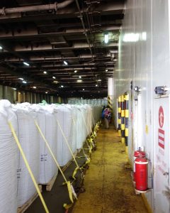 Huge bags of salmon food. There are a lot of salmon farms in southern Chile.
Day 4
Today we finally made it ashore. Before we could dock the crew had to pass a very large rope—probably 6 inches in diameter—to the dock workers. It was very windy and they didn’t catch the rope, so we had to power away from the dock and circle around the bay to try again so the wind wouldn’t crash us against the dock. Luckily, on the second try, we made it with no harm done to the boat. The pier, on the other hand, did not fare so well. It had a giant tire to stop the boat from hitting the concrete that got caught in the rope and when the rope pulled tight it jerked the tire off of the pier and it sank. Terra firma has never felt so good.
by Jason Bowles | Jan 24, 2018 | Jason, South America
Crossing the Andes from Chile to Argentina was originally a commercial endeavor, bringing Chilean goods closer to international markets. The route we followed has been in use since the late Nineteenth Century but foundered after the opening of the Panama Canal just over a hundred years ago. The route survives though, as an enterprising individual recognized its potential and kept the route alive transporting tourists instead of Chilean goods.
We started our journey in Bariloche, Argentina. It was only a short walk from the apartment we had rented to the Hotel Edelweiss, where we caught our first bus. We stowed our packs in the belly of a Greyhound-like bus and began the first leg of our journey along Lake Nahuel Huapi to Puerto Pañuelo, where we boarded our first ferry. For the next hour, we sailed west through a narrow, glacier-carved arm of the same lake to Puerto Blest. Here we found a newly renovated hotel accessible only by this ferry, one of two possible places to break up what otherwise is a 12-hour journey. The hotel was built on a small peninsula separating the crystal-clear waters of the lake from the colored water of the lower Frias river where it discharges its turquoise sediment into Nahuel Huapi. Here, we boarded smaller buses that transported us along 3 kilometers of dirt road to Frias Lake which was colored just like the river.

Crossing Lago Frias
Frias is a much smaller lake, and the second ferry lasted only 30 minutes, bringing us to the last outpost on the Argentine side. We had to wait for the border police (who arrived on the same boat we did!) to get organized before they could stamp our passports and process us out of their country.
The next leg of the journey was the most interesting. The road leading out of Puerto Frias across the frontier was a steep, single lane that switched back-and-forth up from the lake to cross the border between Argentina and Chile. The border in the southern parts of these countries was created by connecting the highest peaks in the Andes. Where we crossed, this was a volcano nearly 11,000 feet high named Tronador. After we crossed the border—marked with a sign and a simple log portal across the road—we had a spectacular view of the peak and the glaciers advancing down from the summit. At this point in the journey, we were in old 4-wheel-drive buses that occasionally had to be outfitted with chains to make the journey.
4×4 bus to take us across the border.
We bumped along this road, descending from the border down into Chile. The road transitioned from the steep mountain road to a pastoral river valley with a few ranches before we arrived at a small “town” called Peulla. A large hotel—Natura—was where we would spend the night, but only after clearing Chilean immigration and customs, not a very efficient process as the 50 of us making the crossing tried to locate our luggage and open every one of our bags for the few customs agents assembled in what amounted to a small plywood shed. After clearing this hurdle, it took some time to sort out the next bit of confusion as company organizing the crossing had only booked one room with three single beds for our family of four.
While we settled in for the evening, the majority of those who started with us boarded the final ferry to cross Lake Todos Los Santos. Peulla is located at the eastern end of the lake where the glacial Peulla river and the volcanic Black river join the lake. In addition, a smaller stream plunged into the lake from the cliffs near the dock on the lake. This stop afforded us a leisure morning and a midday 4×4 tour of the valley, crossing through the Peulla river and boating along the Black River. The highlight for the kids was visiting a nearby ranch that had pigs, goats, llamas, and alpacas.
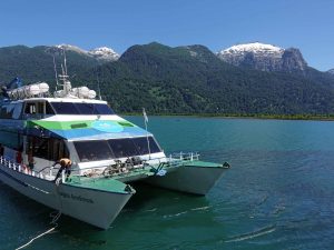
Ferry on Lago Todos Los Santos.
Later that afternoon, we joined the group making the crossing from Argentina that morning, boarded the final ferry and motored for two hours the length of Todos Los Santos. Midway through the journey we rounded a bend and saw our destination, although we did not yet know it. What we saw was the perfect snow-capped cone of the volcano, Orsorno. For the next hour, we watched it grow larger until we finally reached Petrohué on the eastern base of the volcano. Here a bus took us the last hour to Puerto Varas, driving between Osorno to the north and another volcano, Calbuco, to the south, along the shore of Lake Llanquihue. Calbuco last erupted in 2015. The mushroom cloud of the initial explosion was visible over 100 miles away, and for over a month ash from the eruption covered the surrounding towns. All told, over 4 meters of ash had to be cleared to reopen the road.
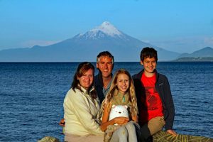
Volcan Orsono
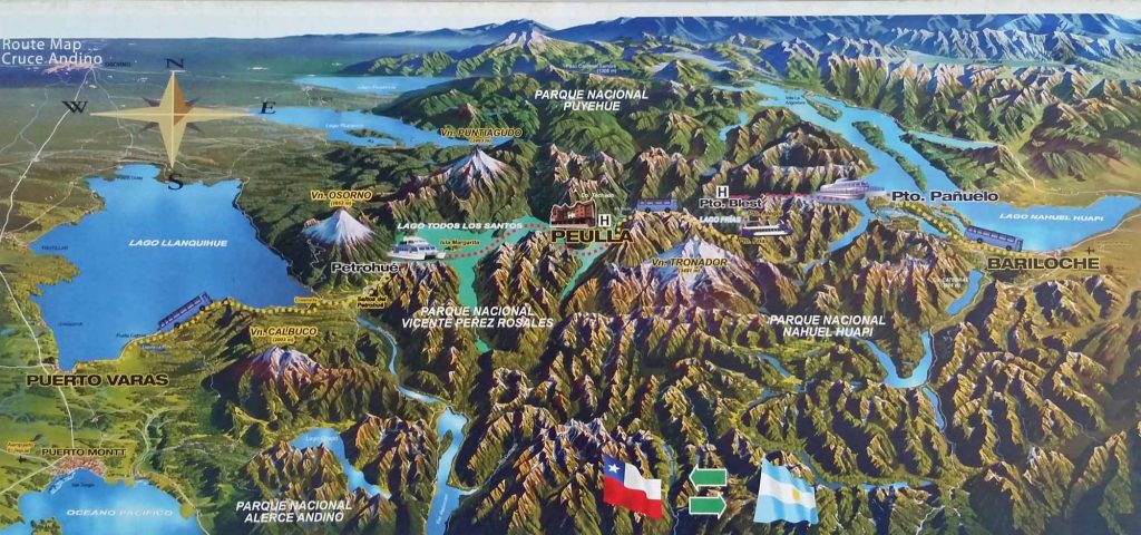
Our route from Bariloche, Argentina, to Puerto Varas, Chile.
by Alex Bowles | Jan 22, 2018 | Alex, South America
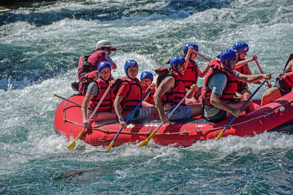
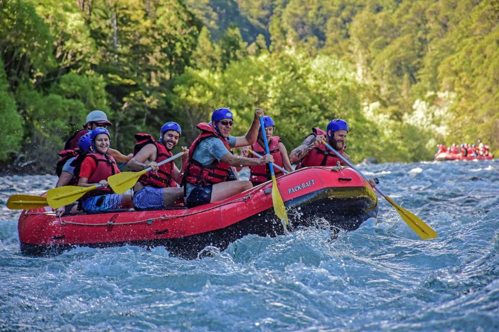
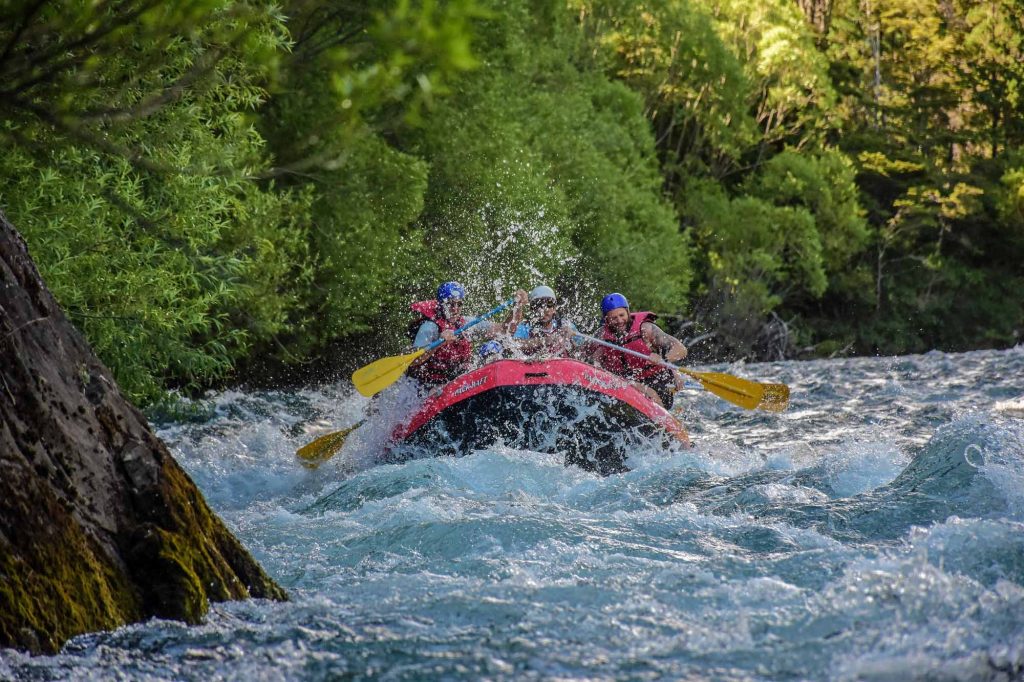
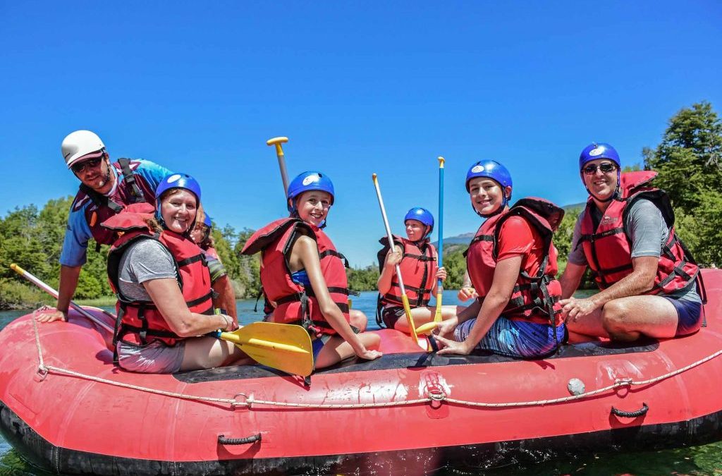
Today we went on a white water raft tour down the Manso river in Argentina. I always wanted to raft down a river with rapids and, as Master Yoda said, “Do, or do not, there is no try”. To get to the river we had to travel across the continental divide; every river to the west of the line flows to the Pacific and those to the east flow to the Atlantic. When we arrived at Stephan lake, where the river started, we found the water to be crystal clear and our guide said that this water was drinkable so I drank straight from the river.
Rafting the Rio Manso.
When we started, we were on a calm lake that was perfect for swimming. The water was cold, not surprising because you could see patches of snow on the mountain peaks above us. In the beginning, there were little rapids but nothing I wouldn’t swim through. Maile almost from the get-go didn’t want to do it so she sat inside the boat and did virtually nothing for the next couple hours. Then, after an hour, we made it to the first rapids. These were only Class II rapids. They felt like driving down a bumpy road with a garden hose spraying you. Before we were near the rapid our guide instructed us how to make it through the rapid without flipping our raft. We had to paddle fast and furiously to negotiate the gauntlet of boulders. When we went over the only Class III rapid it felt like falling three feet in a car, entertaining but unnerving. After we successfully made it through the Class III rapid we did many ludicrous things under our guide Marco’s instructions. We ran class II rapids backward, spinning like a helicopter rotor, and standing up. When we were nearing the end the current slammed our raft into a rock and created a huge wave that soaked my mom and I. Then we had smooth sailing until the end of the tour.