Crossing the Andes from Chile to Argentina was originally a commercial endeavor, bringing Chilean goods closer to international markets. The route we followed has been in use since the late Nineteenth Century but foundered after the opening of the Panama Canal just over a hundred years ago. The route survives though, as an enterprising individual recognized its potential and kept the route alive transporting tourists instead of Chilean goods.
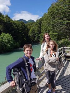
We started our journey in Bariloche, Argentina. It was only a short walk from the apartment we had rented to the Hotel Edelweiss, where we caught our first bus. We stowed our packs in the belly of a Greyhound-like bus and began the first leg of our journey along Lake Nahuel Huapi to Puerto Pañuelo, where we boarded our first ferry. For the next hour, we sailed west through a narrow, glacier-carved arm of the same lake to Puerto Blest. Here we found a newly renovated hotel accessible only by this ferry, one of two possible places to break up what otherwise is a 12-hour journey. The hotel was built on a small peninsula separating the crystal-clear waters of the lake from the colored water of the lower Frias river where it discharges its turquoise sediment into Nahuel Huapi. Here, we boarded smaller buses that transported us along 3 kilometers of dirt road to Frias Lake which was colored just like the river.

Crossing Lago Frias
Frias is a much smaller lake, and the second ferry lasted only 30 minutes, bringing us to the last outpost on the Argentine side. We had to wait for the border police (who arrived on the same boat we did!) to get organized before they could stamp our passports and process us out of their country.
The next leg of the journey was the most interesting. The road leading out of Puerto Frias across the frontier was a steep, single lane that switched back-and-forth up from the lake to cross the border between Argentina and Chile. The border in the southern parts of these countries was created by connecting the highest peaks in the Andes. Where we crossed, this was a volcano nearly 11,000 feet high named Tronador. After we crossed the border—marked with a sign and a simple log portal across the road—we had a spectacular view of the peak and the glaciers advancing down from the summit. At this point in the journey, we were in old 4-wheel-drive buses that occasionally had to be outfitted with chains to make the journey.
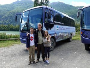
4×4 bus to take us across the border.
We bumped along this road, descending from the border down into Chile. The road transitioned from the steep mountain road to a pastoral river valley with a few ranches before we arrived at a small “town” called Peulla. A large hotel—Natura—was where we would spend the night, but only after clearing Chilean immigration and customs, not a very efficient process as the 50 of us making the crossing tried to locate our luggage and open every one of our bags for the few customs agents assembled in what amounted to a small plywood shed. After clearing this hurdle, it took some time to sort out the next bit of confusion as company organizing the crossing had only booked one room with three single beds for our family of four.
While we settled in for the evening, the majority of those who started with us boarded the final ferry to cross Lake Todos Los Santos. Peulla is located at the eastern end of the lake where the glacial Peulla river and the volcanic Black river join the lake. In addition, a smaller stream plunged into the lake from the cliffs near the dock on the lake. This stop afforded us a leisure morning and a midday 4×4 tour of the valley, crossing through the Peulla river and boating along the Black River. The highlight for the kids was visiting a nearby ranch that had pigs, goats, llamas, and alpacas.
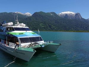
Ferry on Lago Todos Los Santos.
Later that afternoon, we joined the group making the crossing from Argentina that morning, boarded the final ferry and motored for two hours the length of Todos Los Santos. Midway through the journey we rounded a bend and saw our destination, although we did not yet know it. What we saw was the perfect snow-capped cone of the volcano, Orsorno. For the next hour, we watched it grow larger until we finally reached Petrohué on the eastern base of the volcano. Here a bus took us the last hour to Puerto Varas, driving between Osorno to the north and another volcano, Calbuco, to the south, along the shore of Lake Llanquihue. Calbuco last erupted in 2015. The mushroom cloud of the initial explosion was visible over 100 miles away, and for over a month ash from the eruption covered the surrounding towns. All told, over 4 meters of ash had to be cleared to reopen the road.
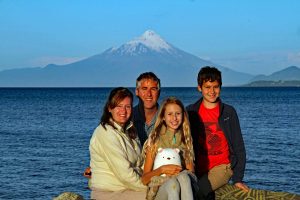
Volcan Orsono
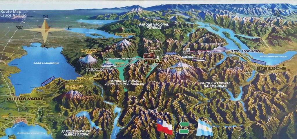
Our route from Bariloche, Argentina, to Puerto Varas, Chile.